
BOOK A SHOOT / GET IN TOUCH
Your next property.
Our next great project.
Tell us where it is, what you need, and when you’d like to shoot. We’ll help you choose the right media package.


LOCAL FOCUS. REGIONAL REACH.
200 miles across.
One creative partner.
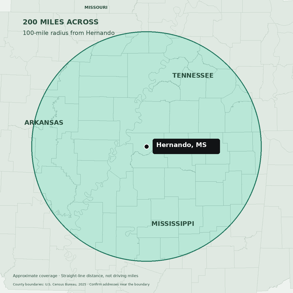
Our standard service area extends approximately 100 miles in every direction from Hernando, Mississippi—a 200-mile diameter covering North Mississippi, the Memphis region, eastern Arkansas, and portions of the Missouri Bootheel.
Travel outside the service area is available for an additional fee, quoted before booking.
Coverage is measured as an approximate straight-line radius from central Hernando, not driving mileage. For counties that extend beyond the circle, only the portions within it are in the standard service area. Send the property address to confirm.
County coverage
All 72 counties that intersect the mapped service area are listed below. Open a state to see its counties.
Mississippi · 32 counties
Within the mapped radius: Alcorn, Benton, Calhoun, Coahoma, DeSoto, Grenada, Lafayette, Lee, Marshall, Panola, Pontotoc, Prentiss, Quitman, Tallahatchie, Tate, Tippah, Tunica, Union, Yalobusha.
Portions within the mapped radius: Bolivar, Carroll, Chickasaw, Choctaw, Clay, Itawamba, Leflore, Monroe, Montgomery, Sunflower, Tishomingo, Washington, Webster.
Tennessee · 16 counties
Within the mapped radius: Crockett, Fayette, Hardeman, Haywood, Lauderdale, McNairy, Shelby, Tipton.
Portions within the mapped radius: Carroll, Chester, Dyer, Gibson, Hardin, Henderson, Lake, Madison.
Arkansas · 22 counties
Within the mapped radius: Craighead, Crittenden, Cross, Lee, Mississippi, Monroe, Phillips, Poinsett, St. Francis, Woodruff.
Portions within the mapped radius: Arkansas, Clay, Desha, Greene, Independence, Jackson, Jefferson, Lawrence, Lincoln, Lonoke, Prairie, White.
Missouri · 2 counties
Portions within the mapped radius: Dunklin, Pemiscot.
Approximate coverage calculated from U.S. Census Bureau 2025 county boundaries. Addresses near the edge are confirmed individually.